Google Earth

by Google LLC

3.7 2.9M+ reviews
611M+ Installs
02/22/2010 Released
Google Earth icon
Google Earth icon
Travel & Local

Google Earth

by Google LLC

3.7 2.9M+ reviews
611M+ Installs
02/22/2010 Released
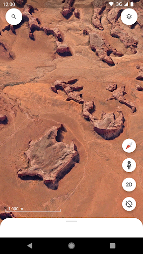
Google Earth screenshot 1
Google Earth screenshot 2
Google Earth screenshot 3
Google Earth screenshot 4
Google Earth screenshot 5
Google Earth screenshot 6

Ratings Breakdown

3.7 ★★★★★ 2.9M+ ratings
5 56%
4 11%
3 6%
2 5%
1 22%

Data from Google Play at the time of writing.

What Google Earth Actually Does

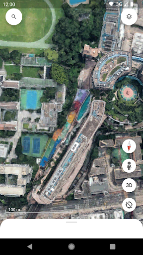
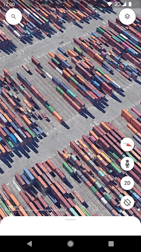
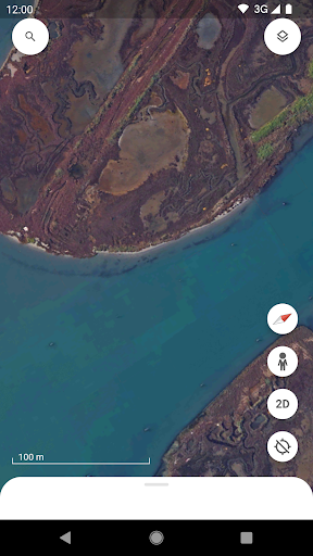
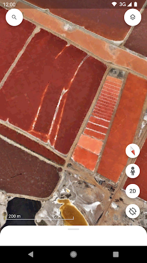
Google Earth is Google’s virtual globe app, letting you spin a photorealistic 3D model of the planet, drop into Street View for a 360-degree ground-level look at a location, or build annotated map projects to share with others. It’s aimed at travelers, hikers, researchers, students, and anyone who just likes poking around satellite imagery of places they’ve been or want to go. The app also includes tools for measuring distances, drawing shapes, and creating collaborative ‘Projects’ that layer photos, notes, and paths onto the map.

Reviewers use it for surprisingly practical purposes: scouting hiking routes, finding photography spots, planning search and rescue missions, and even locating ghost towns to explore in person. That range says a lot about how flexible the core mapping engine is, even if the app around it can be rough.

Where It Genuinely Impresses

When it’s working, users describe Google Earth as one of the best apps they use regularly. One reviewer called the project-building tools easier to use than the desktop Pro version, which is a notable compliment given how long that desktop tool has existed. The 3D rendering of terrain and buildings gets specific praise too, with one user simply calling it ‘decent’ in an otherwise critical review, which for a free mobile app is still meaningful.

The ability to browse from space and then use what you find for real-world activities is repeatedly cited as the app’s biggest draw. People mention using it for hiking, metal detecting, fishing, skiing, and prospecting, treating it less like a novelty and more like a genuine planning tool. That kind of real-world utility, layered on top of a free satellite imagery viewer, is hard to find elsewhere on mobile.

The Crashing and Freezing Problem

The most damaging recurring complaint is stability. Multiple reviewers describe the app crashing constantly or closing immediately upon opening, even after updating to the latest version and reinstalling entirely. One user on a Pixel 7 said the app becomes ‘completely useless’ during these periods, and another said this instability has happened to them before, suggesting it’s a recurring pattern rather than a one-off bug. For an app people rely on for search and rescue or trip planning, this is a serious flaw, not just an inconvenience.

Beyond outright crashes, the Measure tool has its own specific bug where it freezes while the app keeps running, making distance readings unreliable by the time it responds. There’s also a documented glitch where drawing a shape near Antarctica produces a giant circle in the center of the continent instead of following your input, a niche issue but one that shows the mapping logic still has edge cases that haven’t been ironed out.

Control Sensitivity and Missing Basics

Several reviewers single out the touch controls as frustrating. Because zoom, rotation, and tilt are all controlled by finger gestures with no sensitivity adjustment, small movements can send the map spinning or jumping to the wrong continent entirely. This makes precise navigation, like lining up a measurement or inspecting a specific building, more fiddly than it should be.

There are also complaints about missing features that used to exist. One reviewer said a recent version removed the coordinate display at the bottom of the screen and the ‘Tools’ bar referenced in the app’s own help articles, while also introducing an unwanted ‘Your Projects’ element they couldn’t dismiss. Another wished for a basic undo option, since it’s easy to accidentally drag a feature to the wrong location while editing a project, and a full offline mode is still absent for reviewers who want to use the app without a connection.

Who Should Actually Download This

If you want a free, detailed way to explore satellite imagery, scout real-world locations, or build shareable map projects, Google Earth remains genuinely useful and the underlying content is unmatched on mobile. But go in expecting occasional instability, a fiddly control scheme, and the possibility that an update could remove a feature you relied on. Casual browsers will likely be satisfied; people who depend on it for professional or safety-critical work should have a backup plan for when it crashes at the wrong moment.

Pros

  • Rich 3D terrain and building rendering
  • Useful for real-world trip and hike planning
  • Project tools easier than desktop Pro version
  • Street View adds immersive ground-level detail
  • Free access to detailed satellite imagery

Cons

  • Frequent crashes and freezing on some devices
  • Oversensitive, hard-to-control touch gestures
  • Missing undo option and offline mode

What Real Users Say

Karl Freiburghaus (Karlitto Freigante) 4/5

“This app keeps getting better & better all the time, better & easier to generate projects with than the desktop pro version. However, please include an undo option with the app as it is too easy to accidentally drag features to new locations while in edit mode. Also, the app needs an offline mode as it doesn't work when I'm…”

👍 3,876 found this helpful
Dylan Turek 2/5

“The app is amazing when it works. I use it all the time to find interesting photography locations whenever I'm traveling or setting out on a hike. Lately the app crashes constantly. This isn't the first time I've gone through a period of time when the app is completely useless. I have a new pixel 7 and the app shouldn't…”

👍 2,260 found this helpful
Bentley Santee 4/5

“Really good, just there's one bug and a few things I would like to point out. First of all, the bug. For some reason, when you try to make a shape around Antarctica, it makes a giant circle in the center. Another thing I would like to say is that when measuring, every time I try to move the screen…”

👍 2,050 found this helpful

Reviews sourced from Google Play, selected by helpfulness at the time of writing.

App Info & Permissions

Developer Google LLC
Content rating Everyone
Contains ads No
Installs 611M+
Released 02/22/2010
Price Free

Permissions this app requests

📷 Camera Take pictures and videos
👥 Contacts Find accounts on the device
🪪 Identity Find accounts on the device; add or remove accounts
📍 Location Approximate location (network-based); precise location (GPS and network-based)
🖼️ Photos/Media/Files Read the contents of your USB storage; modify or delete the contents of your USB storage
💾 Storage Read the contents of your USB storage; modify or delete the contents of your USB storage

Similar Apps

Frequently Asked Questions

1

What is Google Earth?

Google Earth is a free mobile app from Google that lets you view a 3D model of the planet using high-resolution satellite imagery, explore buildings and terrain in hundreds of cities, and drop into Street View for 360-degree ground-level views. It also includes tools for measuring distances and building collaborative map projects. It's used by travelers, hikers, students, and researchers alike for both casual exploration and practical trip planning.

2

Is Google Earth free to use?

Yes, Google Earth is free to download and use, with no mention of a paid tier in its core mapping and Street View features. Users get access to satellite imagery, 3D terrain, and project-building tools without a subscription. This makes it accessible for casual browsing as well as more serious uses like scouting hiking routes or photography locations.

3

Does Google Earth work offline?

Based on user feedback, a full offline mode is still something reviewers are requesting rather than a feature that currently exists in a reliable form. This means you'll generally need an internet connection to load imagery and use the app's tools. If offline access is essential for your use case, test the app in your specific area before relying on it in the field.

4

Why does Google Earth keep crashing on some phones?

Multiple reviewers report the app crashing constantly or closing immediately on opening, even after reinstalling and updating to the latest version, with one user specifically noting this on a Pixel 7. This appears to be a recurring issue that resurfaces periodically rather than a single isolated bug. There's no universal fix mentioned by users beyond reinstalling, so stability may depend on your specific device and Android version.

5

Is Google Earth good for measuring distances accurately?

The Measure tool is useful but has a reported bug where it freezes during use even though the app itself keeps running, which can throw off readings by the time it responds. Users also mention wanting adjustable control sensitivity, since small gestures can unexpectedly move or rotate the map while trying to measure. It's usable for general estimates but may frustrate anyone needing precise, repeatable measurements.