
نشان | نقشه و مسیریاب Neshan

by نقشه و مسیریاب نشان

4.4 138K+ reviews
29M+ Installs
03/19/2017 Released
نشان | نقشه و مسیریاب Neshan icon
Maps & Navigation

نشان | نقشه و مسیریاب Neshan

by نقشه و مسیریاب نشان

4.4 138K+ reviews
29M+ Installs
03/19/2017 Released
نشان | نقشه و مسیریاب Neshan screenshot 1
نشان | نقشه و مسیریاب Neshan screenshot 2
نشان | نقشه و مسیریاب Neshan screenshot 3
نشان | نقشه و مسیریاب Neshan screenshot 4
نشان | نقشه و مسیریاب Neshan screenshot 5
نشان | نقشه و مسیریاب Neshan screenshot 6

Ratings Breakdown

4.4 ★★★★★ 138K+ ratings
5 72%
4 13%
3 5%
2 3%
1 7%

Data from Google Play at the time of writing.

What Neshan Does and Who It’s For

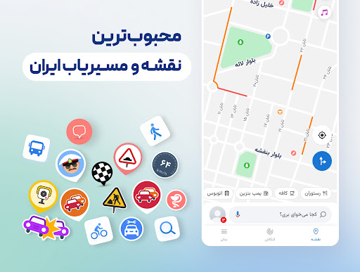
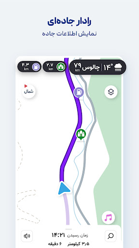
Neshan is a homegrown Iranian maps and navigation app built for drivers, riders, and commuters inside Iran, where Google Maps and Waze data are often unreliable or incomplete. It uses GPS and real-time traffic data to suggest routes, and layers on local-specific features like speed camera and police checkpoint alerts, low-emission and traffic-restriction zone warnings, air pollution monitoring display, and combined bus-and-metro routing. It’s become a default tool for everyday drivers as well as ride-hailing drivers on Snapp and Tapsi, who need dependable, current road data more than flashy design.

Where It Actually Delivers

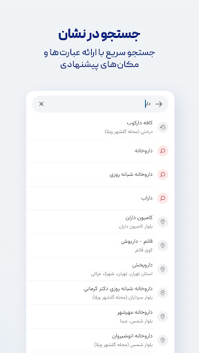
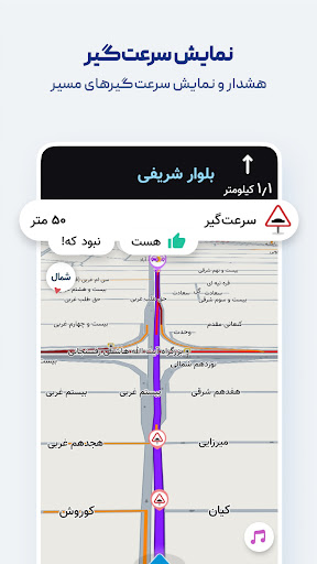
The core navigation experience gets consistent praise from real users. Reviewers call it ‘efficient and optimized’ and say it beats Google Maps and Waze specifically in Iranian cities, metro areas, and highways, which makes sense given it’s built around local road data and restrictions that international apps don’t track well. Persian voice guidance that reads out street names, live traffic overlays, and detection of speed bumps and checkpoints are the features people actually rely on daily, and the offline maps mean the app stays useful even with a weak connection.

The Android Auto Experience Is a Mixed Bag

Multiple detailed reviews single out Android Auto as the weak link. Users report the app crashing after any disconnection, requiring a full restart to work again, plus a zoom level that’s described as too small for a car display. The most repeated request across reviews is showing speed limits on the Android Auto screen the way the mobile app already handles zoom transitions at intersections — right now that mobile-to-car feature gap is the single biggest complaint from otherwise satisfied users.

Bugs and Routing Inconsistencies

Beyond Android Auto, there’s a more serious complaint: one user reported the map simply failing to load altogether, which racked up a large number of ‘useful’ votes, suggesting it wasn’t an isolated case. Another reviewer described the routing logic as contradictory, saying the app guided them into a traffic-restricted camera zone despite settings configured to avoid exactly that, and also mentioned recent delays in route calculation. That same reviewer flagged slow support responsiveness, which matters more here since this is a niche regional app without the broad community troubleshooting that bigger navigation apps have.

Missing Community Features

One suggestion that stands out is a request for user-reported road quality data, like asphalt condition, so routing could favor smoother roads over technically faster ones. It’s a reasonable ask given Neshan already crowdsources some local knowledge implicitly through its checkpoint and camera alerts, and it points to room for the app to lean further into community input rather than just static map data.

Verdict: Who Should Download This

If you’re driving in Iran, Neshan is close to essential — international alternatives don’t have the local road, checkpoint, and restriction-zone data that Neshan built specifically for that market, and the millions of installs and generally strong ratings back that up. If you primarily use Android Auto, go in expecting some friction until the crash-after-disconnect bug and missing speed limit display get fixed. And if you’ve had recent map-loading failures, it may be worth checking community reports before assuming it’s just your device.

Pros

  • Strong local routing beats Google Maps, Waze
  • Persian voice guidance reads street names
  • Speed camera and checkpoint alerts
  • Combined bus-and-metro routing option
  • Offline maps with live traffic data

Cons

  • Android Auto crashes after disconnecting
  • Missing speed limit display on Android Auto
  • Reported map-loading failures and routing delays

What Real Users Say

MohammadReza Zare 4/5

“The latest update for Android Auto is great, but it has a few bugs. One is that after disconnecting for any reason, the app crashes and must be completely closed and reopened to work properly. Another issue is that the zoom is too small for a monitor. Adding a speed section to the mobile app would also be a great…”

👍 103 found this helpful
Mostafa Shahveysi 5/5

“I am completely satisfied with my experience and thank you. But there is one thing that is missing in the Android Auto version and it is really needed. Showing the speed limit on the roads. Overall, if you add the mobile experience to Android Auto, it will be amazing. Thanks again.”

👍 98 found this helpful
Yaghoob Podine 5/5

“neshan is an efficient and optimized navigator. Please optimize the Android Auto version for use in the car. - Like the mobile version, when approaching an intersection and changing directions, zoom back to make it easier to recognize the route. - The speed limit should also be added next to the map and the speed limit for each road should…”

👍 60 found this helpful

Reviews sourced from Google Play, selected by helpfulness at the time of writing.

App Info & Permissions

Developer نقشه و مسیریاب نشان
Content rating Everyone
Contains ads No
Installs 29M+
Released 03/19/2017
Price Free

Permissions this app requests

📍 Location Approximate location (network-based); precise location (GPS and network-based)
🖼️ Photos/Media/Files Read the contents of your USB storage
💾 Storage Read the contents of your USB storage
📶 Wi-Fi connection information View Wi-Fi connections

Similar Apps

Frequently Asked Questions

1

What is نشان | نقشه و مسیریاب Neshan?

Neshan is an Iranian maps and navigation app that uses GPS and real-time traffic data to suggest routes, similar to international navigation apps. It adds locally relevant features like speed camera and police checkpoint alerts, low-emission zone routing, air pollution monitoring display, and combined bus-and-metro directions. It's widely used by everyday drivers and ride-hailing drivers on platforms like Snapp and Tapsi across Iran.

2

Is نشان | نقشه و مسیریاب Neshan free to use?

Yes, based on its store listing and install numbers in the tens of millions, Neshan is available as a free download for navigation and map use. The store description doesn't mention any paywalled premium tier, and reviews focus on features and bugs rather than pricing complaints.

3

Does Neshan work offline?

Yes, Neshan offers detailed offline maps for cities combined with live traffic information when a connection is available. This makes it useful in areas with weak or inconsistent mobile data coverage.

4

Is Neshan better than Google Maps in Iran?

Multiple user reviews claim Neshan performs better than Google Maps and Waze specifically within Iranian cities, metro areas, and highways, largely because it's built around local road restriction data, checkpoints, and traffic patterns that international apps don't track well there. It's described by users as one of the best local navigation tools for that region specifically.

5

Does Neshan work well with Android Auto?

This is currently the app's weakest area according to user feedback. Reviewers report the app crashing after any Bluetooth or connection drop, requiring a full restart, along with a zoom level that's too small for in-car displays and no speed limit display, which mobile users get but Android Auto users currently don't.